Since the early days of Google Earth, organizations have found it to be an excellent tool for tracking the status of coral reefs. Back in 2006, Frank showed you
ReefBase and
Reef Watch, and we've posted a variety of other stories since then. Coral Reefs cover less than 0.1% of the ocean, yet nearly 25% of all known marine species call them home, making them crucial for our oceans ecosystem.
The
World Resources Institute has used Google Earth to create tours of reefs around the world to show threats them from sources such as coastal development, pollution, climate-related threats and others.
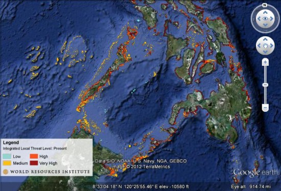
Their tours include photos and underwater video from reefs around the world. Taking it further, they also have created maps to show projected reef maps for the years 2030 and 2050. You can download
this KMZ file
to explore their current data, or grab the KMZ files for the
2030 or
2050 projects.
No comments:
Post a Comment