Met Office - Storm Tracker Beta

The Met Office has created a new Google Maps Flash Map to monitor and forecast tropical storms around the world.
There are two versions of this map - Free and Premium (Paid For)
Free Version
· 1 x forecast weather layer (UK deterministic 5 day storm track)
· 1 x observed track
· 3 x latest weather layers:
· cloud (IR and Visible satellite)
· sea surface temperatures
· Thousands of historic storms (HURDAT data from 1850 until the present).
Advanced version (paid for service)
Additional premium content for an advanced service is available at a subscription rate.
The advanced service includes access to all the above, plus:
· Probabilistic forecasts of storms and weather – so a range of possible scenarios
can be understood
· Met Office 15 day ensemble forecast storm tracks; and equivalent data from
European Centre for Medium-range Weather Forecasting (ECMWF) and USA’s
National Oceanic and Atmospheric Administration (NOAA).
· Multi-model combinations of these leading models
· Additional forecasts for storms, including strike probabilities, forming storms, and
ensemble mean storm tracks
· A utilities layer showing district boundaries for the Gulf of Mexico
Access to these features enables users to build a far more complete picture
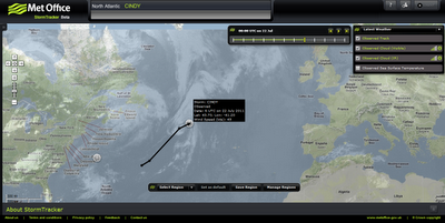
Users require to have an account (even for the free version) worldwide cloud conditions and the locations of current cyclones. If you select a cyclone on the map you can view the cyclone's observed track and wind speeds recorded along the track.
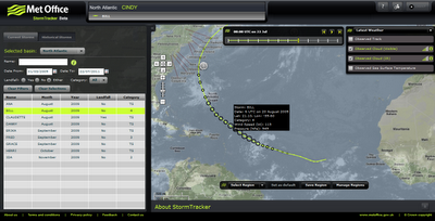
As well as viewing current tropical storm conditions it is also possible to view historical storm information. For example you can view the track of the 2009 Hurricane Bill.
 Storm Tracker Worldwide Map by the UK Met Office.
http://www.metoffice.gov.uk/premium/stormtracker/
(sign up and login required to view both free and premium)
 The Met Office has created a new Google Maps Flash Map to monitor and forecast tropical storms around the world.
There are two versions of this map - Free and Premium (Paid For)
Free Version
· 1 x forecast weather layer (UK deterministic 5 day storm track)
· 1 x observed track
· 3 x latest weather layers:
· cloud (IR and Visible satellite)
· sea surface temperatures
· Thousands of historic storms (HURDAT data from 1850 until the present).
Advanced version (paid for service)
Additional premium content for an advanced service is available at a subscription rate.
The advanced service includes access to all the above, plus:
· Probabilistic forecasts of storms and weather – so a range of possible scenarios
can be understood
· Met Office 15 day ensemble forecast storm tracks; and equivalent data from
European Centre for Medium-range Weather Forecasting (ECMWF) and USA’s
National Oceanic and Atmospheric Administration (NOAA).
· Multi-model combinations of these leading models
· Additional forecasts for storms, including strike probabilities, forming storms, and
ensemble mean storm tracks
· A utilities layer showing district boundaries for the Gulf of Mexico
Access to these features enables users to build a far more complete picture
Users require to have an account (even for the free version) worldwide cloud conditions and the locations of current cyclones. If you select a cyclone on the map you can view the cyclone's observed track and wind speeds recorded along the track.
As well as viewing current tropical storm conditions it is also possible to view historical storm information. For example you can view the track of the 2009 Hurricane Bill.
 Storm Tracker Worldwide Map by the UK Met Office.
http://www.metoffice.gov.uk/premium/stormtracker/
(sign up and login required to view both free and premium)
No comments:
Post a Comment