To celebrate the three year anniversary of the release of the
3D Ocean in Google Earth, they've just released a major update to their bathymetry (underwater terrain) and it looks great!
Similar to their recent update "
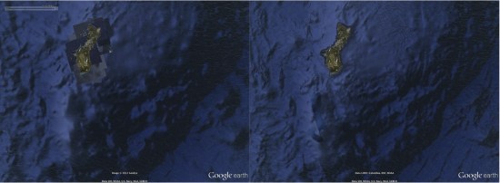
Pretty Earth" update, this one does quite a lot to help clean up stray artifacts and images visible in the ocean. A great example of that is Guam, seen here alongside the Marianas Trench, the deepest trench in the world:

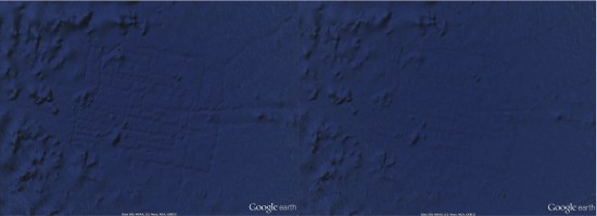
Another noteworthy change is that "Atlantis" is now gone. A few years ago some people thought they had found the lost city of Atlantis, but it turned out to simply be
sonar tracks from a ship. While that was a reasonable and accurate explanation, the sonar tracks were still pretty ugly on the surface of the ocean. They're now cleaned up as part of this update and the area looks as clear as it should:

To see more of what's changed, Google has created this short video to give you a tour:
Combined with the new patchless imagery, the earth is suddenly looking remarkably better all the way around. For more, check out
this entry in the Google Lat Long Blog.
 Another noteworthy change is that "Atlantis" is now gone. A few years ago some people thought they had found the lost city of Atlantis, but it turned out to simply be sonar tracks from a ship. While that was a reasonable and accurate explanation, the sonar tracks were still pretty ugly on the surface of the ocean. They're now cleaned up as part of this update and the area looks as clear as it should:
 To see more of what's changed, Google has created this short video to give you a tour:
Combined with the new patchless imagery, the earth is suddenly looking remarkably better all the way around. For more, check out this entry in the Google Lat Long Blog.
No comments:
Post a Comment