Friday, July 22, 2011

Microsoft Enhances Bing Maps Service Through Gigwalk
Microsoft has launched a new campaign that will allow users to conduct visual surveys and do a wide range of tasks using the Gigwalk app. But, the highlighting point of this new campaign is, however, not the fact that Microsoft is crowd sourcing its projects - but those users who participate in the program, will be paid by the company.
According to reports, thousands of projects have already been assigned to users, the end results of which will be featured into the software juggernaut’s Bing Maps service.
The company announced that over 7,430 tasks will be completed in the region in and around South Florida, most of which will be paying about $5. However, a huge segment of the assignments have been granted to iPhone 4 users as the Apple device is equipped with one of the better smartphone cameras available today.
The company had also revealed that more than 116,000 gigs have been already listed all over the country, while the number of users of the Gigwalk app has already surpassed the 50,000 mark. It’s important to note here that it has been almost a couple of month since the Gigwalk app was unveiled in May this year.
According to reports, thousands of projects have already been assigned to users, the end results of which will be featured into the software juggernaut’s Bing Maps service.
The company announced that over 7,430 tasks will be completed in the region in and around South Florida, most of which will be paying about $5. However, a huge segment of the assignments have been granted to iPhone 4 users as the Apple device is equipped with one of the better smartphone cameras available today.
The company had also revealed that more than 116,000 gigs have been already listed all over the country, while the number of users of the Gigwalk app has already surpassed the 50,000 mark. It’s important to note here that it has been almost a couple of month since the Gigwalk app was unveiled in May this year.
Thursday, July 21, 2011
UCOSP: A model for getting undergraduates involved in Open Source
UCOSP (Undergraduate Capstone Open Source Projects) brings together students from all across Canada to work together on open source projects. Students learn first-hand what distributed development is like. Each team has students from two or three schools, and uses a mix of agile and open source processes under the supervision of a faculty or industry lead. Heading into our fourth year, we believe we have developed a good model for introducing students to open source projects during the regular academic year.
In the past year, we had 78 students from 15 universities across Canada working on 15 different teams. The projects range from web and mobile applications to video processing. We would like to thank the project mentors, faculty mentors, and our sponsors.
Why are we doing this?
In academia, we have long had students working on project courses and even sometimes on open source projects within individual universities. By collaborating with multiple universities, we offer students opportunities that just were not possible at a single institution. UCOSP students are typically enrolled in an independent study course as part of a full load of courses. The infrastructure of UCOSP provides a valuable connection between the goals of an ongoing open source project and the constraints of fitting project work into the academic environment.
By including students from different schools we accomplish several goals:
- Students learn how to interact in a distributed environment. They learn to use IR channels, blog posts, mailing lists, and code reviews to communicate.
- Students work on real systems, with technical mentorship from a project expert and academic oversight from their home university and the UCOSP committee.
- Students meet and compare notes with students from other schools.
- Students from smaller schools have an opportunity that might not otherwise be available to them.
Most importantly, the students have a blast. They rave about their experiences and what they learned, telling us about communication and time management, rather than the cool technology. Of course, another advantage of working in the open source community is the opportunity for students to show prospective employers their peer-reviewed contributions to real projects.
The Code Sprint
Bringing all the students to one location for a 3-day code sprint near the beginning of the term is the key to making UCOSP work so well. All the teams put in three days of hard work to kick start their projects, and by meeting their teammates in the flesh, they develop a stronger bond, and work better together for the rest of the term. Project mentors also attend and get a chance to learn the strengths and weaknesses of their team members. This is the main financial cost of the program.
Academic oversight
One of our challenges has been convincing faculty from a variety of universities that we can provide feedback and effectively monitor the progress of their students. As the program has evolved, we have developed a system for soliciting feedback from both project mentors and students and informing the students and faculty from their home departments about their student’s progress. At the end of the term, the project mentors work with the UCOSP committee to send reports to each student's home faculty mentor. This mentor sometimes requires additional reporting from the student, and combines the committee's recommended grade with their own assessment.
The projects
Recent projects have been quite varied and many have been part of Google Summer of Code: POSIT, ReviewBoard, MarkUs, EOL, and FreeSeer. We try to work with a wide variety of projects to meet the interests of the students.
We are very happy with the success of UCOSP. We'd be happy to talk with anyone about the program and how we have made it work. We are always looking for more open source projects that students can contribute to. It has been a real pleasure to get to know the project mentors and see their enthusiasm. The greatest reward of the program is to see the students arrive at the Code Sprint looking a little overwhelmed, to watch them rise to the challenge, and to see just how much they accomplish in the program.
Googlers Flock to Portland for OSCON
Two weeks from now Googlers from all over the world will be gathering in Portland, Oregon for OSCON, O’Reilly Media’s annual open source convention. OSCON is being held at the Oregon Convention Center from July 25th - July 29th and we are all looking forward to meeting up with 2,000+ of our friends in the open source community.
This year 17 Googlers will be hosting sessions on a variety of topics at OSCON with dozens more attending the open source conference. Below is a comprehensive list of the speakers and their sessions in chronological order.
Tuesday, July 26th
Wednesday, July 27th
Thursday, July 28th
Google will be sponsoring 2 “Ask Google Engineers Anything” sessions after a successful session at last year’s OSCON. The sessions are intended to help developers work better with Googlers and Google technology and to answer most of the questions that developers might be baffled about.
Chris DiBona - "Ask Google Engineers Anything" morning session
"Ask Google Engineers Anything" - afternoon session
Friday, July 29th
Lindsey Simon - "Use 10,000 Browsers or How to Crowdsource, Archive and Share User Agent Data in the Open with Browserscope"
This year OSCON has added two additional conferences co-located with OSCON. OSCON Java, which focuses on open source technologies that make up the Java ecosystem and OSCON Data, the first event of its kind focused solely on open source data infrastructure. We have speakers at both events; for more details click on their sessions below.
OSCON Java - Tuesday, July 26th
Josh Bloch will be delivering the keynote, and then giving a talk later in the afternoon on “The Evolution of Java: Past, Present, and Future”.
OSCON Data Wednesday, July 27th
Robin Anil will host a session on “Hands on Mahout - Mammoth Scale Machine Learning”
We hope to see you at OSCON!
Let Historypin is guiding you
Editor’s Note: Today's guest author is Nick Stanhope, co-founder and executive director of an awesome and inspiring website out of the UK called Historypin. We collaborated with the site for its launch as a beta last year, and Nick is writing a guest post to announce today's official launch of Historypin with a new mobile app and expanded global availability. His team’s labor of love illustrates the amazing ways individuals and organizations can use Google Maps and Street View to share new (or in this case, old) views of the world around us.
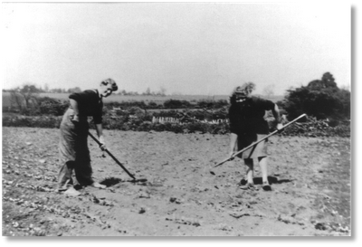
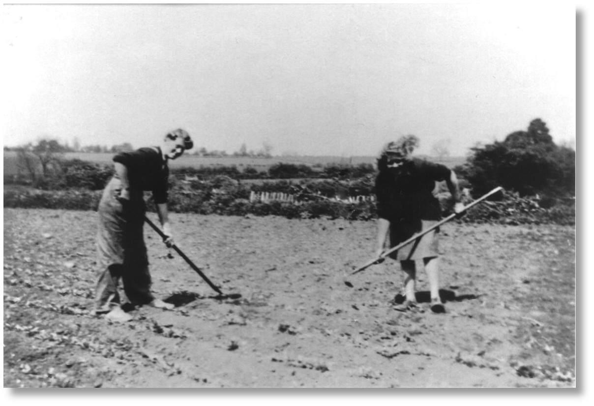
A few years ago, just before she passed away, my Gran and I spent a lot of time together looking through some of her old photos and family videos, sharing stories and learning a bit more about each other’s lives. This picture of my Gran and Great Auntie Jenny, working as land girls in the summer of 1943, was one of my favourites.
 Everyone can identify with this sense of wistfulness and nostalgia that memories often evoke. Sometimes it’s triggered by talking to a grandparent about what they did at your age, by learning more about the guy in the photo who looks like a Victorian version of your Uncle Phil, or by chatting with an older neighbour about how different Main Street looked fifty years ago.
This is what Historypin is all about: conversations between different generations and neighbours, time spent around sights and sounds of the past, stories remembered and shared and comparisons made between then and now. And today, we’re thrilled to announce its graduation from last year’s beta phase with worldwide availability, the addition of a new mobile app, and a bunch of other exciting new developments.
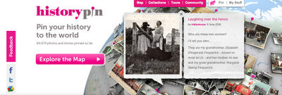
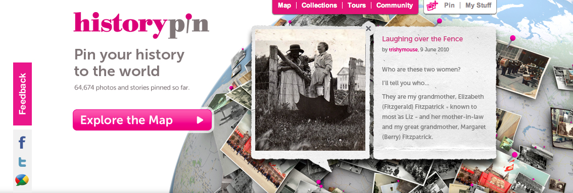
Historypin is a website and smartphone app that uses Google technology in new and creative ways. You can explore old photos, videos and audio clips that have been “pinned” onto Google Maps (which you can search not only by location but also by date), compare these glimpses of the past with how they look in today by seeing them overlaid onto Street View, immerse yourself in local history using the Android app, journey through Tours and Collections of featured content and, best of all, “pin” your own history as photos, videos, audio clips and stories to the site.
 And by continuing to work closely with Google, we’re excited about the improvements to come as well. Later this year, we’ll launch additional new features like embed tools that enable you to put Historypin on your own site, Historypin channels that will allow you to create your own distinct experiences, and pinning games that invite the community to pin content that we and our partners know little about.
But, really, it’s not about the tech. It’s about those conversations - little ones, across families and streets, and big ones, involving millions of citizen historians. Through all of these conversations, we can create a place to explore history in amazing ways and help families and neighbourhoods come together around what we all share: history.
A few years ago, just before she passed away, my Gran and I spent a lot of time together looking through some of her old photos and family videos, sharing stories and learning a bit more about each other’s lives. This picture of my Gran and Great Auntie Jenny, working as land girls in the summer of 1943, was one of my favourites.
 Everyone can identify with this sense of wistfulness and nostalgia that memories often evoke. Sometimes it’s triggered by talking to a grandparent about what they did at your age, by learning more about the guy in the photo who looks like a Victorian version of your Uncle Phil, or by chatting with an older neighbour about how different Main Street looked fifty years ago.
This is what Historypin is all about: conversations between different generations and neighbours, time spent around sights and sounds of the past, stories remembered and shared and comparisons made between then and now. And today, we’re thrilled to announce its graduation from last year’s beta phase with worldwide availability, the addition of a new mobile app, and a bunch of other exciting new developments.
Historypin is a website and smartphone app that uses Google technology in new and creative ways. You can explore old photos, videos and audio clips that have been “pinned” onto Google Maps (which you can search not only by location but also by date), compare these glimpses of the past with how they look in today by seeing them overlaid onto Street View, immerse yourself in local history using the Android app, journey through Tours and Collections of featured content and, best of all, “pin” your own history as photos, videos, audio clips and stories to the site.
 And by continuing to work closely with Google, we’re excited about the improvements to come as well. Later this year, we’ll launch additional new features like embed tools that enable you to put Historypin on your own site, Historypin channels that will allow you to create your own distinct experiences, and pinning games that invite the community to pin content that we and our partners know little about.
But, really, it’s not about the tech. It’s about those conversations - little ones, across families and streets, and big ones, involving millions of citizen historians. Through all of these conversations, we can create a place to explore history in amazing ways and help families and neighbourhoods come together around what we all share: history.
How To Use Google Maps to Show Your Geographic Competence
There have been a lot of complaints about real estate appraisers appraising properties in an area they are unfamiliar with.
Saturday, July 16, 2011
Updating the Maps of France, Monaco, and Luxembourg
The only constant is change, and today we’re proud to announce further progress in our ongoing effort to build a map that can reflect the changes that occur in the real world. Just as we’ve started using map data from a wide range of authoritative sources in the US, Canada, and a number of other countries, we have now updated the base map data for France, Monaco and Luxembourg.
You'll notice improvements in all of our Google Maps products and services for those three countries, such as more comprehensive maps of cities and hillsides. Integrating specialized map data from highly respected organizations like the Institut Geographique National will help both locals and visitors more quickly and easily navigate these unique places.
What’s more, starting today you can share your direct feedback about the maps for France, Monaco and Luxembourg. When you’re zoomed in to any of these regions, you’ll now see the "Report a Problem" tool in the lower right corner of the map. So if you want to tell us about any updates you think need to be made - like a street becoming one-way, or a new housing development in your area - let us know and we’ll do our best to update the map quickly, often within just a few days.
You'll notice improvements in all of our Google Maps products and services for those three countries, such as more comprehensive maps of cities and hillsides. Integrating specialized map data from highly respected organizations like the Institut Geographique National will help both locals and visitors more quickly and easily navigate these unique places.
What’s more, starting today you can share your direct feedback about the maps for France, Monaco and Luxembourg. When you’re zoomed in to any of these regions, you’ll now see the "Report a Problem" tool in the lower right corner of the map. So if you want to tell us about any updates you think need to be made - like a street becoming one-way, or a new housing development in your area - let us know and we’ll do our best to update the map quickly, often within just a few days.
The 2011 National Geographic Bee Champion
After preparing for months and working their way through a field of several million participating students, the top 10 geographic student masters, met in Washington D.C. today at National Geographic headquarters to compete in the National Geographic Bee. After 124 questions (including the championship round), Tine Valencic from Texas answered this one correctly to take the championship crown:
Question: Thousands of mountain climbers and trekkers rely on Sherpas to aid their ascent of Mount Everest. The southern part of Mount Everest is located in which Nepalese national park?Answer: Sagarmatha National Park
Google is proud to support National Geographic Bee, for the 3rd year in a row. National Geographic and Google share the same passion for inspiring and encouraging our future generation of leaders and innovators to learn about and explore the world around them. Being geographically literate and understanding the world is a vital skill for students of all ages. Technology, like Google Earth, has helped make the world a more accessible place and students need geographic skills to be prepared for a global future.

The first-place winner, Tine Valencic, won a $25,000 college scholarship, a lifetime membership in the National Geographic Society, and a trip to the Galápagos Islands. The second-place winner and recipient of a $15,000 college scholarship was Georgia's Nilai Sarda and third place and a $10,000 college scholarship went to Kansas' Stefan Petrović. The seven other finalists, who won $500, were Andrew Hull, of Alaska: Luke Hellum, of Arizona; Tuvya Bergson-Michelson, of California; Kevin Mi, of Indiana; Karthik Karnik, of Massachusetts; Alex Kimn, of South Dakota; and Anthony Cheng, of Utah.

Congratulations to Tine Valencic and to all of the students who participated in this year’s National Geographic Bee. We look forward to following all of you as you continue to explore the world and we expect to see some of you at Google after you have earned your degrees.
Displaying Labels on top of Bing Maps Custom Tile Layers
Before I go any further, I ought to mention that any credit for this post should go to Bing Maps MVP Nicolas Boonaert, who first pointed out this technique in this post on the MSDN Bing Maps forum. Thanks Nicolas!
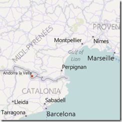
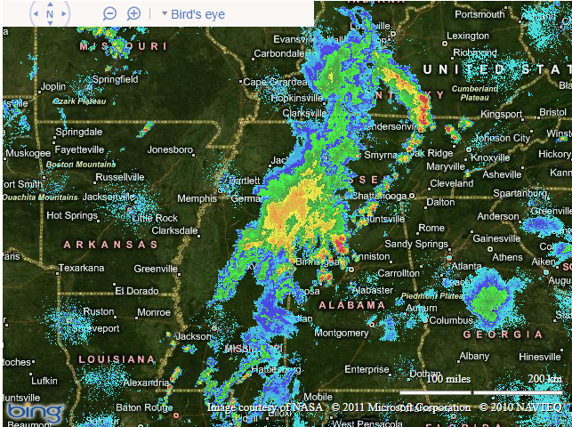
Generally speaking, when you place custom tile layers on a Bing Map, they are superimposed on top of a base tile layer. Historically, that tile layer could either use the road map style, or the aerial style (with or without label), as shown below:
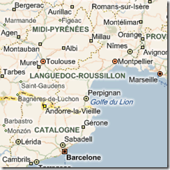 Road Map Style (“r”) |
|
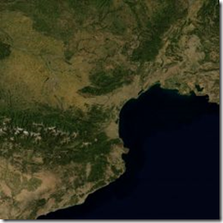 Aerial Map Style no labels (“a”) |
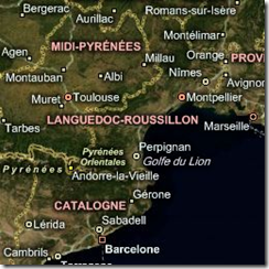 Aerial Map Style with labels (“h”) |
Then last year, a new “Lavender” road map style was introduced in two flavours – one with labels and one without:
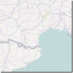 New road map style no labels (“r”, “stl=h”, “lbl=l0”) |
 New road map style with labels (“r”, “stl=h”) |
However, as Nicolas pointed out, it seems that we also now have the ability to request transparent tiles that contain only the labels, separate from any other features of the map. These labels are available in styles to match both the “old” and “new” road map styles, as follows:
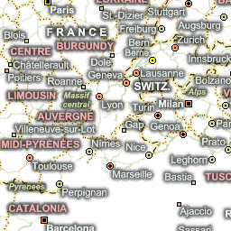 “Old” Label only style (“ho”) |
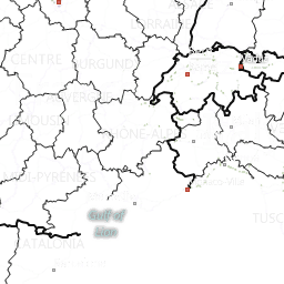 “New” Label only style (“ho”, stl=”h”) |
// Define the tile layer source
var labelTileSource = new Microsoft.Maps.TileSource({ uriConstructor: 'http://ecn.t2.tiles.virtualearth.net/tiles/ho{quadkey}?g=671&mkt=en-US' });

// Construct the layer using the tile source
var labelTilelayer = new Microsoft.Maps.TileLayer({ mercator: labelTileSource, opacity: 1.0 });

// Push the tile layer to the map
map.entities.push(labelTilelayer);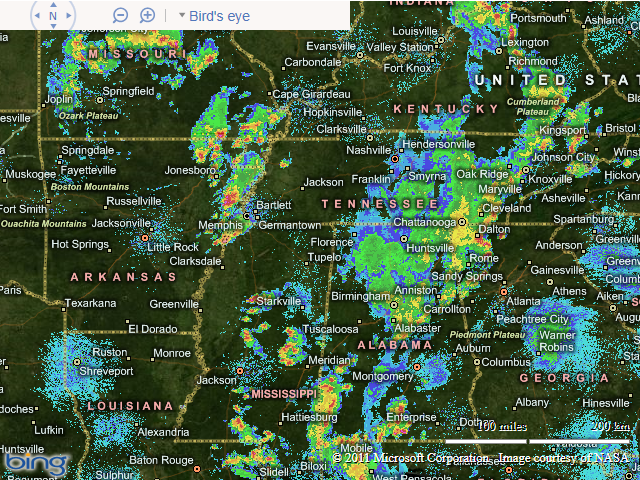
Friday, July 15, 2011
The new Android Market for phones, with books and movies
Recently, we’ve been hard at work improving Android Market to give you new ways to find great applications and games, purchase books, and rent movies. Today, we’re releasing a new version of Android Market which makes all of these available on phones (Android 2.2 and higher).
In the U.S., you’ll be able to rent thousands of movies, starting at $1.99, right from Android Market on your phone. With the Videos app, available in Android Market, there’s no more waiting for downloads, syncing, or worrying about storage space. Simply sign into Android Market with your Google account, and you can rent movies from anywhere – the web, or your Android phone or tablet – and start watching instantly. You can also download movies to your device so they’re available for viewing when you don’t have an internet connection.
Also in the U.S., you can now purchase books from Android Market on your phone. Like movie rentals, books are linked to your Google account, so they’re instantly available across all of your devices – computer, phone, or tablet – without the need for wires or downloads.
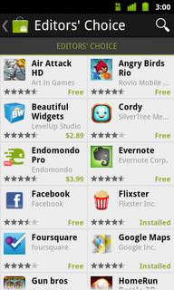
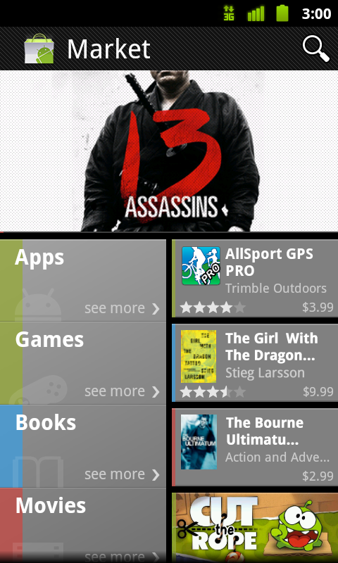
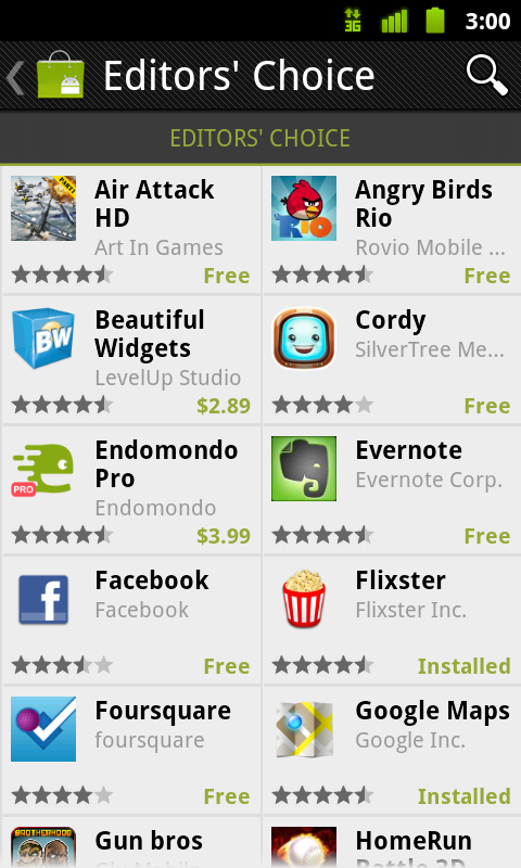
You’ll be delighted to find we’ve overhauled Android Market to make it faster, easier, and more fun to discover great apps, movies, and books. We’ve created more space to feature some of the most interesting content of the week on the home page. We’ve added more top charts, with newer, more relevant items, and we’ve made it easy to swipe through these charts as you browse the store. We’ve also introduced new collections of great content, like staff picks and Editors’ Choice apps.

 The new Android Market will be rolling out in the coming weeks to Android 2.2 and higher phones around the world. You don’t need to do anything - the update is automatic on supported phones. If you’re in the U.S., you’ll also be able to download the Videos app, rent movies, and buy books once you receive the new Android Market.
Your phone is about to get a lot more interesting! Enjoy the new Android Market.
In the U.S., you’ll be able to rent thousands of movies, starting at $1.99, right from Android Market on your phone. With the Videos app, available in Android Market, there’s no more waiting for downloads, syncing, or worrying about storage space. Simply sign into Android Market with your Google account, and you can rent movies from anywhere – the web, or your Android phone or tablet – and start watching instantly. You can also download movies to your device so they’re available for viewing when you don’t have an internet connection.
Also in the U.S., you can now purchase books from Android Market on your phone. Like movie rentals, books are linked to your Google account, so they’re instantly available across all of your devices – computer, phone, or tablet – without the need for wires or downloads.
You’ll be delighted to find we’ve overhauled Android Market to make it faster, easier, and more fun to discover great apps, movies, and books. We’ve created more space to feature some of the most interesting content of the week on the home page. We’ve added more top charts, with newer, more relevant items, and we’ve made it easy to swipe through these charts as you browse the store. We’ve also introduced new collections of great content, like staff picks and Editors’ Choice apps.
Your phone is about to get a lot more interesting! Enjoy the new Android Market.
Tuesday, July 12, 2011
Nokia X7
Nokia X7 Testing
Testing of the New Nokia X7 is going well, impressed with the solid build and speed of the new operating system.

If you like a solid metal feel to your phone own the Nokia X7. Too many smartphones simply look.The Nokia X7 is all about standing out from the crowd with its opt-angular sided styling. It’s a winner.
New Nokia Maps (3.08) Reviewed
This comes with a new version of Nokia Maps, 3.08. which brings a number of changes to the Drive (car navigation) functionality of the application. The new feature is the ab
utility to use live traffic information to automatically re-route you around traffic delays. New look and feel to the user interface ( have added "Just drive" mode), This version has can set a contact as a destination and an easier to use settings menu. The new beta also marks the brand switch from the Ovi Maps back to Nokia Maps.
Nokia Maps 3.08 beta is available for all Symbian 3 devices: Nokia N8, Nokia C7, Nokia C6-01, Nokia X7, Nokia E6 and Nokia E7.
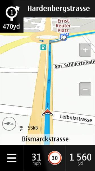 Faster Nokia Maps - And GPS Fix with assisted GPS is fast under 30 seconds.
(source of image All About Symbian)
Camera - X7 Camera Shots
http://www.flickr.com/photos/gletham/sets/72157627044792323/
by Glenn Letham
http://www.flickr.com/photos/roland/with/5920752728/
and Roland Tanglao
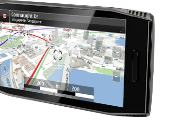
Testing of the New Nokia X7 is going well, impressed with the solid build and speed of the new operating system.
Stands out with a 4-inch AMOLED Screen - 8 megapixel Camera creates an impressive 3264 x 2440 pixels image (image from http://noknok.tv/) great for viewing HD videos and Photos.
The Nokia X7 is the only smartphone with a large Nokia 4-inch screen. The larger screen means movies come to life and playing games is a great deal more immersive [tested].
Screen size also views maps and navigation effortlessly. No QWERTY keyboard (uses the virtual keyboard sans input) then the Nokia X7 is the way to go.
Symbian Anna Operating System
Symbian Anna is the latest version of the Symbian installed on the Nokia X7, delivering a faster and smoother user experience, quicker load times and a host of new features. Comes with a 680 MHz processor.
Unique Design and Solid Build.
If you like a solid metal feel to your phone own the Nokia X7. Too many smartphones simply look.The Nokia X7 is all about standing out from the crowd with its opt-angular sided styling. It’s a winner.
New Nokia Maps (3.08) Reviewed
This comes with a new version of Nokia Maps, 3.08. which brings a number of changes to the Drive (car navigation) functionality of the application. The new feature is the ab
utility to use live traffic information to automatically re-route you around traffic delays. New look and feel to the user interface ( have added "Just drive" mode), This version has can set a contact as a destination and an easier to use settings menu. The new beta also marks the brand switch from the Ovi Maps back to Nokia Maps.
Nokia Maps 3.08 beta is available for all Symbian 3 devices: Nokia N8, Nokia C7, Nokia C6-01, Nokia X7, Nokia E6 and Nokia E7.
(source of image All About Symbian)
Camera - X7 Camera Shots
http://www.flickr.com/photos/gletham/sets/72157627044792323/
by Glenn Letham
http://www.flickr.com/photos/roland/with/5920752728/
and Roland Tanglao
Plastic is dead bring on the stainless steel
Nice design, the age old plastic phones is gone a makes the smartphone sporting and good to hold. The stainless steel of the Nokia X7 adds sturdiness without compromising on weight. Expect a rugged life.
Big thanks to womworld/1000heads for their organising and hospitality so far. Post will be updated through the weekend.
Map of the Ranch with Photos..
Google Maps: Film Locations
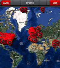 Spott is a mobile phone application that lets you check for nearby places that have been used in movie or TV scenes.
Using Spott you can view a Google Map that shows locations near you that have been used in iconic scenes in films and TV shows. You can also search a particular city for locations or search by actor or film.
Registered users of Spott can add locations to the map and can even take photographs of themselves at film locations and add them to the Spott image gallery.
Spott is available both for the iPhone and Android phones.
Filmaps
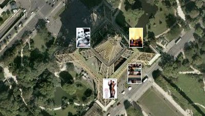
Filmaps is a film locations website that also uses Google Maps to show the locations of movies. Filmaps want to help movie fans find the locations in their favourite movies.
It is possible to search Filmaps for a particular film or it is possible to search a location to see which film was made there. For example, a search for the Eiffel Tower reveals that four films in the Filmaps database have used the famous landmark as a location.
Each film has its own Google Map. When you are browsing a film's locations it is very easy to add another location if you know of one that hasn't already been added. To do so you just press the 'add a location button' and complete a very short form.
Movie Landmarks

Brian Lane's MovieLandmarks.com is a "location-based movie landmark search engine". Location and media data are added by users and the resulting data is then mashed up for all to explore! For an example check out this Blues Brothers landmark.
The post is "lifted" from Google Maps Mania
Monday, July 11, 2011
@JHuber – Head Of Local at Google, Needs Tweeting Ideas
For those of you that may have forgotten, Jeff Huber is new Head Of Local And Commerce at Google. Jeff is one of the top five folks at Google, having been appointed to the post in the reorg of early April when Larry Page took over. He is in charge of Places, Offers, Maps, & Boost to name a few.
I am sure he is a busy guy but he seems totally (or is it intentionally?) clueless about Twitter and his recent experiment there seems to reinforce that point. Here is a tweet that he sent out Saturday night at 6:30 EST:
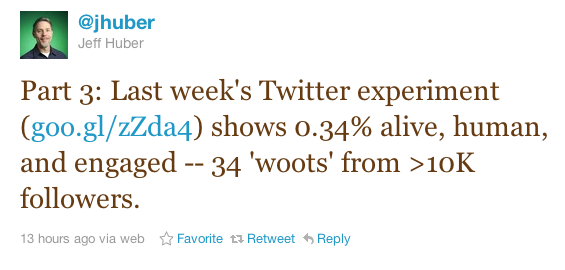
Here are part one and part two of his “experiment” upon reaching 10,000 followers on Twitter:

Since his appointment to the head of Local on April 8 he has tweeted a total of 20 times (17 “original” and 3 Rts). Here is a typical tweet from one of the folks in the world that is probably more influential over our lives in Local than God:

I am traveling but I have a huge favor to ask of you all. Send @jhuber a woot, woot tweet today and let him know what you would like to hear about local from Google. I am sure that you can think of something.
Disease Mapping with the Google Maps API
The mapping of diseases has a long and distinguished history.
Perhaps the most famous disease map is the spot map created by John Snow in 1854. Snow created his map to plot an outbreak of cholera in Soho, London. The map helped to prove that the Soho outbreak of the disease was caused by water that came from one pump in Broad Street.
The dominant theory at the time was that cholera was caused by "bad air", so John Snow's map helped to prove that water was the true cause of the disease.
This video gives a good account of what John Snow's map making achieved,
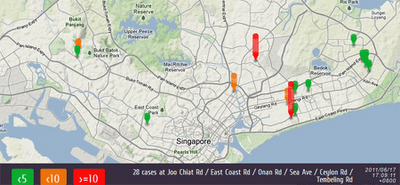
WaetherLah has created this Google Map to track cases of Dengue Fever in Singapore. The map uses dynamic map markers to show the number of cases reported at different locations in the city-state.
Google also has a Dengue Trends website that uses a number of search terms as indicators of dengue activity. Google Dengue Trends uses aggregated Google search data to estimate dengue activity and then creates a heat-map to display locations where there is currently likely to be high Dengue activity.

HealthMap is a Google Maps based application that plots real-time worldwide infectious disease outbreaks from around the world.
The map gathers data from disparate sources, including online news aggregators, eyewitness reports, expert-curated discussions and validated official reports.
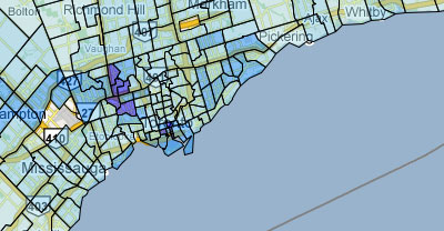
Back in 2009 the Toronto Star created five different Google Maps showing the rates of Chlamydia, Gonorrhoea, HIV, Infectious Syphilis and Other Syphilis in different neighbourhoods in the city. The data for the maps was supplied by the Ministry of Health in response to a freedom of information request.
A good analysis of the maps is available on the Toronto Star's website here. It would be interesting, to see these maps in conjunction with other data, such as average income, levels of health insurance etc.
Also See
Mapping Swine Flu - a round-up of the outbreak of mapping following the Swine Flu epidemic in 2009
Perhaps the most famous disease map is the spot map created by John Snow in 1854. Snow created his map to plot an outbreak of cholera in Soho, London. The map helped to prove that the Soho outbreak of the disease was caused by water that came from one pump in Broad Street.
The dominant theory at the time was that cholera was caused by "bad air", so John Snow's map helped to prove that water was the true cause of the disease.
This video gives a good account of what John Snow's map making achieved,
WaetherLah has created this Google Map to track cases of Dengue Fever in Singapore. The map uses dynamic map markers to show the number of cases reported at different locations in the city-state.
Google also has a Dengue Trends website that uses a number of search terms as indicators of dengue activity. Google Dengue Trends uses aggregated Google search data to estimate dengue activity and then creates a heat-map to display locations where there is currently likely to be high Dengue activity.
HealthMap is a Google Maps based application that plots real-time worldwide infectious disease outbreaks from around the world.
The map gathers data from disparate sources, including online news aggregators, eyewitness reports, expert-curated discussions and validated official reports.
Back in 2009 the Toronto Star created five different Google Maps showing the rates of Chlamydia, Gonorrhoea, HIV, Infectious Syphilis and Other Syphilis in different neighbourhoods in the city. The data for the maps was supplied by the Ministry of Health in response to a freedom of information request.
A good analysis of the maps is available on the Toronto Star's website here. It would be interesting, to see these maps in conjunction with other data, such as average income, levels of health insurance etc.
Also See
Mapping Swine Flu - a round-up of the outbreak of mapping following the Swine Flu epidemic in 2009
Sunday, July 10, 2011
Google's 45º imagery for summer vacation
School is out and it’s time to pack those bags and get ready for summer vacation! We’ve been working hard to get everyone the latest imagery from all over the world. Does your family have any annual traditions? If not, now is a great time to start some, check out our latest additions for some great ideas on where to travel this summer.
What a better way to start a tradition than to visit the happiest place on earth, Disneyland in Anaheim, CA! Use Google Maps to scout out the area, plan out your multi-day adventure all in the comfort of your own home before you head out and enjoy the sites and scenes found there.
View Larger Map
While you’re in sunny Southern California, you can check out Downtown Los Angeles, Universal Studios in Hollywood or visit the Staples Center, home of the 16-time NBA Champions Los Angeles Lakers.
View Larger Map
If you’re a baseball fan, nothing says summer like a good ole fashioned baseball game. Grab your baseball cap and head over to the Baseball Grounds of Jacksonville in Jacksonville, FL, home of the Suns! Downtown is just around the corner from the stadium.
View Larger Map
So whether it’s by plane, train or automobile, from all us at Google, have a great and safe summer. Check out the this map that shows you where all of our 45º imagery lies.
Full list of updated cities:
Anaheim, CA. Jacksonville, FL. Tampa, FL. North Las Vegas, NV. Los Angeles, CA. Downey, CA. La Chaux de Fonds, CH. Visalia, CA. Corona, CA. Meadowlake, NM. Continental Ranch, AZ .Picture Rocks, AZ. Greater Sun Center, FL, Bastrop, TX. Martinez, CA. Paradise Valley, AZ. West New Orleans, LA. Fentress, VA.
What a better way to start a tradition than to visit the happiest place on earth, Disneyland in Anaheim, CA! Use Google Maps to scout out the area, plan out your multi-day adventure all in the comfort of your own home before you head out and enjoy the sites and scenes found there.
View Larger Map
While you’re in sunny Southern California, you can check out Downtown Los Angeles, Universal Studios in Hollywood or visit the Staples Center, home of the 16-time NBA Champions Los Angeles Lakers.
View Larger Map
If you’re a baseball fan, nothing says summer like a good ole fashioned baseball game. Grab your baseball cap and head over to the Baseball Grounds of Jacksonville in Jacksonville, FL, home of the Suns! Downtown is just around the corner from the stadium.
View Larger Map
So whether it’s by plane, train or automobile, from all us at Google, have a great and safe summer. Check out the this map that shows you where all of our 45º imagery lies.
Full list of updated cities:
Anaheim, CA. Jacksonville, FL. Tampa, FL. North Las Vegas, NV. Los Angeles, CA. Downey, CA. La Chaux de Fonds, CH. Visalia, CA. Corona, CA. Meadowlake, NM. Continental Ranch, AZ .Picture Rocks, AZ. Greater Sun Center, FL, Bastrop, TX. Martinez, CA. Paradise Valley, AZ. West New Orleans, LA. Fentress, VA.
Saturday, July 9, 2011
The Facts of Uni Courses
This post is of interest to those in education but hasn't anything to do with maps beyond discussing a GIS course.
Best Buy Facts of Uni Courses: Recently its been announced that English universities will have to collate and publish a set of 'key facts' about each course they offer to the public, kind of the equivalent of the Annual Percentage Rate (APR) that credit cards must publish enabling customers to easily compare card with card to see how much interest they'll be paying. In theory I like the idea but the devil is in the detail of what measures you use and what they communicate to students. Amongst a series of possible problems that were suggested at the GEES conference I was at last week one is particularly close to my heart: the measure of teaching contact time with staff. I unpack this issue in the rest of this post.
Value of Blended Learning: The main project I'm working on this summer is developing a blended learning course: We have over 300 students due to take a second level GIS course this autumn and who need to complete practicals on computers. Running standard face to face computer room practicals has obvious problems so this year I am rewriting the practicals so they can be completed without face to face support. In effect we are making a big investment (my time) to produce highly polished written materials. These will offer students a better learning experience whilst avoiding the cost of face to face support. Students can still get staff support but it will be via forums and drop in sessions. If I can pull it off, blended learning offers the best solution for the staff and students in this situation.
Contact Time = Good? The problem is that this blended learning solution reduces staff contact time. Every student will think that high contact time with tutors is a good thing when looking at the key facts sheet. However, that measure has not included the value of my highly polished practicals that (I hope) more than make up for the lack of direct support.
My expertise in converting courses to blended learning comes from my time at the Open University who offer distance learning courses with even less contact time, I wonder what they think?
Mapping the World's Sea Turtles
Powered by a network of well over 500 people, the SWOT (State of the World's Sea Turtles) database is one of the most comprehensive global databases of sea turtle nesting sites around. You're able to view all of the data on a customizable Google Map, and as you'd expect, you can download a KML file
 to view all of the data inside of Google Earth.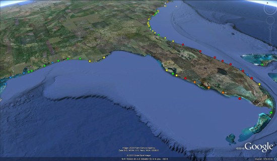
The map is highly detailed and customizable, allowing you to filter by location, and it highlights both the species and colony size with various colored shaped icons.
The depth of data on the map is quite impressive as well, containing data for over 120 countries around the world. If you're familiar with the WIDECAST Atlas, the SWOT database includes their dataset in there and displays them together. All of the SWOT reports and non-interactive map data can be found over at www.seaturtlestatus.org.
If you're looking for more ocean conservation tools in Google Earth, you can check out these ocean biographic maps from a few years ago, or simply dive in and explore the ocean itself, a feature available since Google Earth 5 was released a few years ago.
iPhone as a work station
 During the Tuesday afternoon session of Getlisted Local University it became clear that big changes were going on at Google with an interface upgrade AND Google+. Jeff Huber, Google VP of Local and commerce, kept leaving juicy comments on my blog and I just didn’t want to be off the grid….
But we had scheduled some family time at a friend’s cottage at Rondeau Provincial Park in Ontario. The problem wasn’t that we had scheduled family time, my family understands and even enables my blogging addiction. It was that there was NO wifi for 20 miles although there was some sporadic cell coverage. Because I travel rarely and when I do, have access to hotel wifi, I don’t have 3g for my laptop.
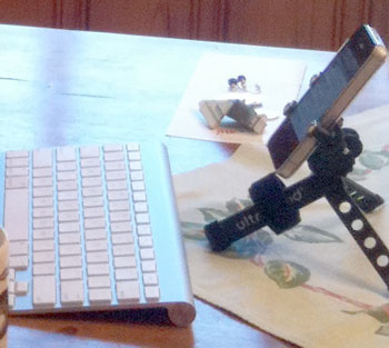
My solution? An iPhone with just enough accessories that allowed me to “keep on posting”. Here are the details of my setup for those of you that want to travel lightly, aren’t willing to pony up for a Macbook Air with a Verizon card and are willing to make a few compromises.
Ingredients:
-my iPhone
-an Ultra Pod stand. cost: $24.99
-an Apple wireless keyboard. cost: $49.
-the mobile WordPress app
Total cost: $75 + tax.
The WordPress iPhone app has gotten very good, the keyboard is simple to sync and is very light and the tripod serves triple duty for me as a bike accessory, AV stand and a monitor display when blogging. You could cut costs on both the stand and the keyboard but both are durable and very functional in this configuration (and they look good too
 ). The only thing holding me back from traveling exclusively this way is my need for last minute PowerPoint updates prior to presenting.
I’d be curious to hear of others who have made the switch to a smartphone instead of a laptop as travel device.
Subscribe to:
Posts (Atom)