- Create and share routes and maps
- Search for routes from other members or our featured brands
- Print Ordnance Survey mapping
- Find places of interest and attractions
- Check the weather and local news.
- upload gpx or kml files for creating routes
- save as gpx to hand held gps unit (only garmin gps products supported)
Friday, April 29, 2011
Ordnance Survey Leisure
Thursday, April 28, 2011
Maps of Disasters
After a period of a relative calm over the last two years Australia has been struck again by several major natural disasters, such as flush floods in Queensland and Victoria, tropical cyclone Yasi, or bushfires in Western Australia. Events like these bring online crowds of people: those caught inadvertently in the incidents, or those concerned about safety of their family members and friends, but above all, “curious onlookers” from around the world who just would like to know what is happening. All those people are looking for basic information, such as maps of places to identify where “these things” reported in commercial and social media are happening, as well as anything that relates to progress of the event, likely scenarios it may evolve into and the impact on people, infrastructure and the surrounding environment.
In the first instance they turn to official sites run by State authorities - those that issue the alerts and warnings - and of course the Australian Bureau of Meteorology. When they can’t find what they are looking for, or the information is not in the format that is meaningful, they turn to online search engines seeking more details about the event. It is therefore not a coincidence that during the times of natural disasters the traffic to sites providing information on maps goes through the roof. A question comes to mind if there really is enough tools in the public domain to keep general public fully informed. Has anything changed since Victorian bushfires of 2009?
In an ideal world, all the relevant information would be provided by the authorities, along with alerts, warnings, evacuation orders, road closures and detour routes, situation briefs etc. And through all possible channels: online, stationary and mobile phones, radio and TV, and in all formats: text, audio and video broadcasts and online streaming, printed as well as static and interactive maps, and above all, web services for republishing the information through media and social channels. But that is still only a distant dream. The reality is that information is very fragmented, differs in formats and content from State to State and ultimately in reliability, accuracy and timeliness.
So, what information is actually available, in spatial format, to an average person interested in a particular event? Let’s start with bushfire related information as there is quite a few resources available...
Part 1: Mapping Bushfires
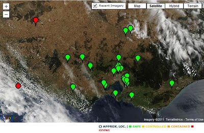
Detection of fire hotspots from satellites has been around for quite a while and Australia has two systems delivering such information that pre-dates Victorian bushfires of 2009: Geoscience Australia’s Sentinel and Landgate’s FireWatch. Both are using data obtained from the NASA Earth Observation Satellites Terra and Aqua which pass over Australia up to three times a day (although a revisit of the same area is only two times a day). Although data has some limitations, like timeliness due
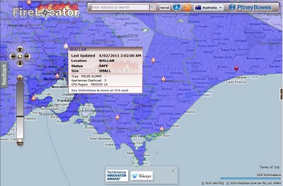
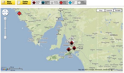
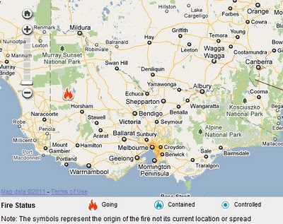
to infrequent revisit cycle or inability to detect hotspots through thick smoke and clouds, these applications provide excellent location reference for larger fire outbreaks throughout Australia. Geoscience Australia publishes the data in KML, WFS and WMS formats. I use those in my Hazard Monitor Bushfire Incidents map to publish an alternative view of the information. FireLocator from PitneyBowes provides yet another version of the same data in Silverlight format and with Bing Map in the background.
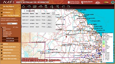
North Australia Fire Information is an application dedicated to monitoring fires in the northern part of Australia. In addition to satellite detected fire hotspots it also includes information on fire scars from past bushfires. Some of the information available on this site can be accessed in KML and WMS formats.
Wednesday, April 27, 2011
Experimental APIs for Chrome extensions
- The Web Navigation Extension API allows extension developers to observe browser navigation events. These events fire both for top-level navigation and in-page navigation. The API therefore allows an extension to keep track of exactly what page (or section thereof) the tab is showing, and how the user got there. We foresee a number of use cases for this API, including extensions that gather and present statistical or benchmarking data, safe-browsing extensions, and developer tools.
- The Proxy Extension API closes one of our most popular feature requests, allowing users to configure Chrome’s proxy settings via extensions. Proxies can be configured for the entire browser or independently for regular and incognito windows. Configuration options range from setting a single proxy server to installing remote or even local PAC scripts. A sample extension demonstrates these capabilities.
Let us know if you create something cool with one of these APIs. If we like it, we may feature you in the extensions gallery.
Open Source Software class visits Google
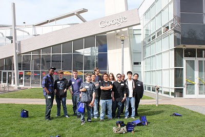
Earlier this month the class was treated to lunch and a tour of Google’s headquarters in Mountain View, CA. During lunch, the students had a chance to sit down with members of the Open Source Programs Office and ask questions about working in open source. They talked with Junio C Hamano, maintainer of the GIT project, Ian Hickson, writer for the HTML5 spec, and Carol Smith, administrator for Google Summer of Code and Google Code-in.
Grading Made Easy using Apps Script
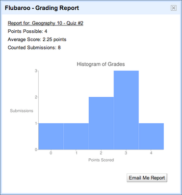
Flubaroo is designed as a simple grading solution for teachers using existing tools they're already comfortable with. It allows automated grading of quizzes and assignments administered via Google Forms. Beyond just grading, Flubaroo also provides analytics such as a histogram of grade distribution and identification of questions that many students missed. Flubaroo’s most popular feature is its ability to email each student their grade, along with the answer key if desired.
Here are the key reasons I chose Google Apps Script to implement Flubaroo:
- I wanted to build a simple application which can be easily integrated with Spreadsheets without the need to compile and deploy code.
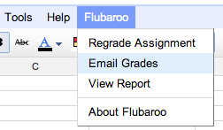
- I liked its ability to integrate right into the spreadsheet as a menu, easily giving teachers access to all of Flubaroo's features.
- Apps Script provided UI Services which allowed me to build UI applications very easily from within a browser. I did not have to install complex tools to create a UI.
- Apps Script Services makes it very easy to integrate other Google APIs such as Google Charts API for the grade histogram.
- A JavaScript syntax is easy to program and without the need to learn more complex languages like Java and Python.
- Apps Script gave me the ability to easily share my grading technique with other teachers through the Apps Script Gallery. It is very easy for anyone to install the Flubaroo script in their Apps Script editor.
One of the great features of Apps Script is the availability of Triggers and Events. Events helped me provide a menu to the users. I created an onOpen function which installed a menu on the spreadsheet every time the spreadsheet is opened by a user. This allows users a menu based access to the various functions in the script.
If you’d like to give it a try then please install the script from the Apps Script gallery. You can also visit Flubaroo website to go through a full tutorial of the script. Thanks to Apps Script, grading assignments is no longer a chore for me.
Real-World Sightings experiment
We’re always working to provide an up-to-date, accurate reflection of the real world through our products. On Friday we learned of many additional sightings through reports submitted by our users, and we have decided to pause the beta until we can provide more comprehensive coverage of these mystical creatures.
We’d also like to take a moment to thank the Google SketchUp users who helped us create the 3D models for this experiment: Aerilius, Athinaios, Bdhy, BerylDrue, Fingerz, Jan Wesbuer, KangaroOz, NESUA, and Zoungy.
GOCE Releases New Geoid Model of the Earth
A new geoid model has been released by the GOCE satellite mission. Included in the release is an animated geoid model. A geoid is a gravity map of the earth that compensates for ocean currents and variations in sea level.
Monday, April 25, 2011
Check out the latest from the Developer Sandbox at Google I/O 2011
For those of you joining us via I/O Live, you can submit and vote on questions you’d like to ask our partners via Google Moderator. We will be taking the most popular questions and conducting video interviews with Sandbox partners. The videos will be posted to the Sandbox page on the following day.
Also, stay tuned on the Google Code Blog where we’ll be featuring guest bloggers from Sandbox companies in the days leading up to I/O.
For those of you joining us in person, we’ll see you in San Francisco. For everyone around the world, tune in to I/O Live and don’t forget to submit questions for Sandbox companies via Google Moderator!
Dusty Reid plans and manages many events at Google each year, including Google I/O. He works at Google's office in beautiful Boulder, Colorado.
Christine Songco works with developers in Southeast Asia, although before and during Google I/O she wears many additional hats. Christine likes to travel, scuba dive, and snowboard in her spare time, which she hopes to discover again when I/O is over for the year.
Former student pays it forward as a mentor for Google Code-in
Charlie Gordon was a student participant in the Google Highly Open Participation Contest, an earlier version of Google Code-in that pairs high school students with mentors in open source projects. Here he discusses his recent experience as a Mentor for the 2010-2011 Google Code-in.
There were so many great stories from Google Code-in that it's hard to pick out just a few. I'm always so excited to get young people involved in open source - I remember how excited I was when I participated in the Google Highly Open Participation Contest myself back in 2007-2008. The program opened many exciting doors for me, including going to Drupal conferences, becoming involved in Drupal core development, and even eventually going to college at MIT, where I am now. It brings me great joy to be able to help open the same doors for the next generation of bright young open source enthusiasts.
Now for the stories! I'm always impressed when students, who are used to doing only what they're specifically told to do for school assignments, go above and beyond. Especially in the format of a contest where the incentives lead students to do the bare minimum, I find those students who put in a real effort to go above and beyond are those who really care about the open source project, and are those who are most likely to stick with it after the contest ends. Here are some of these students:
A student from Thailand, "chalet16", worked on five complex coding tasks for Drupal's style guide module. Over many iterations with the tasks' mentor, the quality of chalet16's code improved, and he also became more comfortable with using drupal.org's issue queue, a key part of our development process. Not only were the tasks well done, but when chalet16 encountered software bugs in parts of the code that he wasn't working directly on, chalet16 had no problem taking the initiative and opening new issues for the bugs, even submitting additional patches to those issues that fixed the problem. That's exactly the kind of participation that we want to attract to our project, and to open source software development in general.
Despite not having very much experience in PHP, “aantn,” a student from Israel, found ways to contribute to the Drupal project, such as by writing a Python script to survey test coverage statistics for Drupal core and the top 50 or so modules. We now have a much better idea of where and to what extent our automated testing system is being used, and making such statistics public will hopefully encourage module maintainers to write more test coverage for their code.
We specified a task that called for a Drupal core patch to allow a "full preview" button on the content submission form. Halfway through the task, Romanian student "bluman," encountered big roadblocks to that patch. After discussing the issue, we realized that the task would not work as a patch for Drupal core, but would have to be rewritten from the ground up as a contributed module. However, rather than give up, bluman worked hard to redo the task as a module, and came up with fantastic results.
Finally, we set a task to translate a small to medium sized module into another language. Another student from Romania, “ungureanuvladvictor," went way above and beyond the task description, translating one of the largest and most widely used contributed Drupal modules into Romanian. The translation file had more than 1,000 translations in it, a very impressive feat for such a short period of time. I had to scramble to find a Romanian speaker willing to review such a large translation!
Really, there are so many impressive students out there.
By Charlie Gordon, Drupal.org mentor
We always hope that the students who participate in programs like Google Code-in and Google Summer of Code develop a bond with the open source community they work with during the program and continue to contribute to the community long after the contest ends. Charlie Gordon is a prime example; he not only continues to be actively involved in the Drupal community but he is also sharing his experience and wisdom with younger developers and helping them become contributors to open source.
New photo browsing experience in Google Earth
To start, make sure the “Photos” layer is checked in the left layers panel and zoom down to your area of interest.
As an example below, check out the Golden Gate Bridge in San Francisco, CA. You will see photo icons on top of the satellite images. The larger photo icons indicate larger collections or clusters of photos. Click on any photo icon to open the Photos window.
Whether you’re deciding between Paris, Beijing or Venice for a nice vacation or simply want to go on a quick virtual getaway after a long day, we hope this new way of viewing photos in Google Earth helps bring places around the world to your fingertips.
If you’d like to contribute to our efforts of building a virtual atlas of the real world and have amazing photos you’d like to share, you can do so by uploading them to Panoramio.com.
Android for Good at Google I/O 2011
Android for Good evolved from a program at Google started by one passionate engineer with an idea to help the developing world through technology. A small team collected Android devices from Googlers around the world and organized their donation to groups including Grameem’s AppLab Community Knowledge Worker Initiative in Uganda, Save the Elephants in Kenya, V-Day in the Democratic Republic of Congo, VillageReach in Mozambique, VetAid in Tanzania & Kenya, and UNHCR in Central Africa.
This year, we want to make it easy for everyone at Google I/O to get involved as well. We know you like to keep up to speed with the latest and greatest technology, so you may have an older Android device you don’t need anymore. If that device is unlocked (such as the T-Mobile G1, Nexus One, or Nexus S) and in good working condition, bring it along to Google I/O and drop it off at the Android for Good booth, located on the third floor of Moscone Center. Although it might seem old to you, that device could mean a new beginning when placed in the right hands.
Zi Wang is a Product Marketing Manager on the Android Team. In his 20% time, Zi is working on a very cool project called Android in Space.
Sunday, April 24, 2011
Saturday, April 23, 2011
Friday, April 22, 2011
Prediction API: Every app a smart app
Today, we are releasing v1.2 of the Google Prediction API, which makes it even easier for preview users to build smarter apps by accessing Google’s advanced machine learning algorithms through a RESTful web service.
Some technical details of the Prediction API:
- Chooses best technique from several available machine learning algorithms.
- Supported inputs: numeric data and unstructured text.
- Outputs hundreds of discrete categories, or continuous values.
- Integrates with many platforms: Google App Engine, web and desktop apps, and command line.
- v1.2 improvements:
- Simpler interface: automatic data type detection, and score normalization.
- Paid usage tier.
- Improved usage monitoring and faster signup through the APIs Console.
- Recommendation: What products might a user be interested in? (example)
- Filter RSS feeds, user comments, or feedback: Which posts are most relevant? Should a user comment be featured? Which feedback should we look at first? (example)
- Customize homepages: Predict what content a user would like to see and populate the page with the user’s anticipated interests.
- Sentiment analysis: Is this comment positive or negative? Does a commenter support Group A or Group B?
- Message routing: Route emails to the appropriate person based on analysis of the email contents.
- See the Prediction API website for many more!
We would also like to continue to thank our supportive preview users for their help making the API the service it is today. We look forward to seeing many more of you join us in making the web just a little bit smarter, and hearing your thoughts and feedback through our discussion group.
Световната банка представи интерактивна световна карта
Целта на създаването на картата, както и на други подобни инициативи на банката, е да се информира обществото за това, как се разпределят парите и да се стимулират богатите да помагат повече на по-бедните държави. Чрез тази карта може да се повиши и нивото на отчетност на правителствата, които получават от средствата.
Преди създаването на интерактивната карта, информацията можеше да се получи само след безкрайно ровене в хиляди страници с финансови документи. Никой не знаеше къде точно и за какво отиват парите по проектите на Световната банка. Сега положението е значително подобрено.
Картата е създадена благодарение на десетки неуморни стажанти, които са извадили информацията. В чисто технически план информационната услуга е изградена чрез картографските системи GeoIQ и Blue Raster. Вече с няколко щраквания на мишката може да се получи информация за различни проекти на обща стойност 168 милиарда щатски долара.
Световната банка работи главно с правителствата на отделните държави, а благодарение на новата инициатива обикновените граждани ще получат достъп до информация, която преди дори не са подозирали, че съществува.
Картата е достъпна на следния адрес: http://maps.worldbank.org/
Заплатата на Ерик Шмид с над един милион долара
Като изпълнителен директор Ерик Шмид получаваше заплата от един долар на година. Сега той вече работи за сумата от 1.25 милиона щатски долара годишно. Към договора му има и опция за бонус, който може да достигне 400% от основната заплата.
Ерик Шмид
Бившият шеф на Google вече получи щедра награда след напускането на високия си пост. Той прибра ни повече, ни по-малко от 100 милиона долара под формата на акции и други активи. В началото на януари той обяви, че смята да продаде 534 хиляди от акциите си в най-голямата търсачка. В момента тези акции струват около 280 милиона долара.
Въпреки голямото увеличение на заплатата и щедрата компенсация от Google доскорошният директор няма намерение да промени обичайните си всекидневни разходи. Според Форбс, сумите за които се говори по-горе са джобни пари за Шмид, който притежава състояние, оценявано на 6.3 милиарда долара.
iPhone следи тайно местоположението на притежателя си
Информацията за местата и времето, по което човек е бил там се събирала в скрит файл, който се съхранява в устройството под некодирана форма. Това са разкрили специалистите по цифрова сигурност Аласдар Алън и Пит Уордън.
Всеки, който притежава необходимия софтуер може да източи от дадено устройство информацията за всички места, където е ходил неговият собственик, твърдят специалистите. От Apple все още не са коментирали това разкритие. Засега няма данни за наличието на механизъм, който да изпраща файлът с информацията на трети страни, но това не значи, че такъв не съществува.
За първи път информацията за разкритието е била публикувана в британския вестник Guardian. Новината идва като гръм от ясно небе за потребителите, които използват мобилните устройства iPhone и iPad 3G. Джаджите не дават никакви видими индикации, които могат да подскажат на собственика, че информацията за неговото местоположение се записва в специален лог.
Специалисти по сигурността са разгледали условията за ползване, които поставя Apple на своите клиенти и според тях практиката на тайно записване на местоположенията не е в разрез с указанията.
Авторите на откритието са заявили, че следенето на потребителите е въведено напълно умишлено и преднамерено. Това е станало през месец юни 2010 година с поредното обновяване на мобилната операционна система iOS.
Щатски полицаи ровичкат в чужди смартфони по време на рутинни пътни проверки
Сдружението за защита на граждански права ACLU обвини мичиганската полиция, че извлича лична и неприкосновена информация от телефоните на хората в нарушение на четвъртата поправка в конституцията на САЩ. Има данни, че органите на реда използвали и специализирани устройства, които позволяват достигането до защитена с парола информация.
„Мобилните телефони съдържат информация, която според много хора е лична и неприкосновена от полицията и други правителствени агенции. Ако полицията разглежда информацията в телефоните директно на пътя, тогава има реална опасност от злоупотреби.”, е мнението на Марк Фанчър, който е адвокат на ACLU.
От личните смартфони лесно може да бъде извлечена информация за религиозните предпочитания и политическите пристрастия на рутинно проверяваните граждани, което е силно нежелателно. В законовата уредба на САЩ има неясноти заради наредби, които не са актуални на днешното ниво на технологичното развитие. Полицията се възползва от тези неясноти и пропуски за да получи колкото се може повече информация.
По летищата в САЩ също се претърсват лаптопи и телефони рутинно, без никакви конкретни причини.
Skype отстрани критичната уязвимост в приложенията за Android
В новата версия на приложението разработчиците са "запушили" установената преди седмица "дупка". През нея хакерите можеха да получат достъп до личните данни на потребителите, включително до потребителското им име, адреса на електронната им поща и историята на кореспонденцията им в Skype.
Тази уязвимост беше открита при тестовете на ранната бета версия на клиента за операционната система Android с поддръжка на видео разговори. По-късно обаче редакторът на блога Android Police, открил уязвимостта, установил още, че тя присъства и в официалната версия на Skype, предлагана в Android Market.
Оказало се, че мобилното приложение съхранява всички лични данни на потребителите в споделена папка, достъпът до която е свободен. Така при хакване или кражба на смартфон или таблет, на който е инсталирано приложението Skype, атакуващите могат без разрешението на потребителя да получат достъп до тези данни.
Skype най-популярната услуга за IP телефония и видео. Освен компютърното приложение са достъпни и мобилни версии на Skype, в частност за платформите iOS и Android.
Синът на Евгений Касперски отвлечен в Москва?
Тайните служби и полицията вече два дни издирват 20-годишния Иван Касперски, е съобщил полицейски източник пред агенция "Интерфакс”.
От фирмата на баща му - Kaspersky Lab, са заявили, че не могат да потвърдят информацията, че младежът е отвлечен.
Евгений Касперски натрупва състоянието си чрез разработването на антивирусен софтуер.
Новината за похищението на сина му беше първоначално съобщена от руския новинарски сайт Life News, който цитира собствени неназовани източници.
Похитителите са поискали 3 млн. евро, за да върнат Иван невредим, съобщава сайтът.
Според непотвърдена информация, той е бил отвлечен, докато е отивал към работното си място в Москва във вторник.
Пред руския вестник „Газета” от Kaspersky Lab са заявили, че могат нито да потвърдят, нито да отрекат информацията.
Като цяло по казуса не е направен нито един официален коментар.
Извън Русия Kaspersky Lab се възприема като една от малкото фирми, чийто успех в бизнеса не е свързан с енергийния сектор.
Американското бизнес списание Fast Company наскоро постави Kaspersky Lab в Топ 50 на най-иновативните компании в света.
New York Times триумфира след въвеждането на платен достъп до сайта си
Компанията е привлякла над 100 000 нови потребители, откакто въведе онлайн абонаментната си услуга на 28 март 2011 г. Този факт опровергава някои мрачни прогнози, направени от анализатори, за евентуалния неуспех на платения онлайн достъп. Изчисленията показват, че компанията ще получи около 26 млн. долара годишни приходи вследствие на нововъведението.
Този нов модел на таксуване на потребителите се наблюдава отблизо от вестниците от общ характер и с широко съдържание, които търсят нови форми на привличане на приходи на фона на понижаващи се рекламни постъпления и намаляващ брой читатели на печатните си издания.
Едва няколко вестника, специализирани главно във финансовите новини, а именно Wall Street Journal на News Corp и Financial Times на Pearson PLC, с успех въведоха платения достъп до онлайн съдържанието си, припомня агенция "Ройтерс".
News Corporation, например, представи платената си онлайн услуга за британските издания Times и Sunday Times през юли 2010 г. Заедно двата вестника до момента имат 79 000 месечни електронни потребители, при 50 000 в края на октомври 2010 г.
New York Times - фирмата, която издава едноименния вестник, както и ежедневника Boston Globe, съобщи в четвъртък, че постъпленията й от печатна реклама са спаднали рязко, което занижава и цялостните й резултати за приходите и печалбата за първото тримесечие.
Verizon все още умува дали да разпространява PlayBook
Въпреки че производителят на BlackBerry – RIM, обяви, че очаква Verizon Wireless да стане един от партньорите му в дистрибуцията на PlayBook, от компанията отвърнаха, че все още не са взели решение по този въпрос.
„Все още правим оценка на BlackBerry Playbook и не сме взели еднозначно решение дали ще го разпространяваме или не”, обяви Бренда Рейни, говорител на Verizon Wireless, цитирана от агенция „Ройтерс”.
Този коментар дойде в сряда - един ден, след като PlayBook беше пуснат в магазинната мрежа и при електронните търговци в Северна Америка.
Според първоначалните данни продажбите на устройството, което е отговорът на RIM на таблета iPad на конкурента му Apple, са под всякакви очаквания.
Анализаторите критикуват остро PlayBook заради липсата на вградени функции за имейл и органайзер, за достъп до които устройството се нуждае от BlackBerry. Освен това в голяма част от отрицателните мнения за таблета се посочва, че той е бил пуснат на пазара, преди да е напълно готов.
Verizon Wireless е съвместно предприятие между Communications Inc и Vodafone Group Plc.
Apple изпревари Nokia по приходи от продажби на телефони
„Пресметнахме, че приходите на Apple от продажби на едро на нейното подразделение, отговарящо за телефона iPhone, са 11,9 млрд. долара за първото тримесечие на 2011 г.”, съобщи старши анализаторът от Strategy Analytics Алекс Спектър. „За първи път Apple изпреварва Nokia, която е отчела много по-ниски приходи от продажби на едро в размер на 9,4 млрд. долара”, допълни той.
От анализаторската компания отбелязват, че Apple е завладяла този пазарен дял за по-малко от четири години.
„Патентованата екосистема на Apple, състояща се от хардуер, софтуер и услуги се оказа изключително популярна и извънредно печеливша”, обясни директорът на Strategy Analytics Нийл Моустън.
Nokia остава най-големият производител на мобилни телефони в света от гледна точка на доставките, показват данните. Доставките на мобилни устройства на Nokia са се повишили с 1% през първото тримесечие до 108.5 милиона, докато Apple е продала 18,6 млн. устройства iPhone за същия период.
Продажбите на Apple се изстреляха във висините след като тя пусна своя iPhone, което от своя страна стимулира и продажбите на другите устройства на компанията, като iPod и таблета iPad. Обратно, пазарният дял на Nokia се свива, докато тя се опитва да въведе операционна система, която да може да се конкурира с интерфейса на Apple. През февруари Nokia съобщи, че операционната й система Symbian ще бъде заменена от Windows на Microsoft Corp като основна система за смартфоните й. Въпреки това, компанията очаква преходът към Windows да отнеме около две години.
Базираната в Бостън Strategy Analytics отбелязва, че конкурентите на Apple й "дишат във врата", особено тези, които използват операционната система Android на Google Inc. Анализаторите очакват броят на телефоните, работещи под Android, да надмине тези с операционната система на Apple до края на 2011 г. Според Strategy Analytics партньорството на Nokia с Microsoft също би могло да бъде заплаха за доминиращата позиция на Apple на пазара на мобилни телефони.
Google APIs Python Library goes to Beta
Today, we are announcing a major milestone for one of the Google APIs client libraries. The Google APIs Client Library for Python has officially reached Beta. This means that we're comfortable enough with the stability and features of the library that we'd like you to start building real production applications on top of it and send us your feedback. Client libraries in other languages are soon to follow.
If you are interested in getting more familiar with our new client libraries, we hope to see you at the “Introduction to Google APIs” lecture at I/O Bootcamp and the “Life of a Google API Developer” session at Google I/O, where you can chat with the developers of the libraries face-to-face.
An Update on Tags
Google Still Advertising HotPot
Google Hotpot was discontinued as a distinct product line last week. It was merged into Places and the Hotpot brand was summarily executed.
Apparently the folks promoting it on Adwords have not yet been informed of the change. I saw this ad today.
Thursday, April 21, 2011
Wednesday, April 20, 2011
Tuesday, April 19, 2011
Monday, April 18, 2011
Sunday, April 17, 2011
Saturday, April 16, 2011
Friday, April 15, 2011
Thursday, April 14, 2011
Wednesday, April 13, 2011
SuperPages – Let Your Fingers Do Less Walking
-
The consumer white pages have been totally removed from the book. I am not sure many will notice. That trimmed 113 pages of paper as well as and shipping costs.
More significant (and I am sure the reason behind the white pages trimming) is that the YP ad pages dropped from 182 to 137 pages. That’s a 24.7% drop. Given that print size, book size and ad sizes all remained constant it means that display advertising is way down. On the first page of the yellow pages, Superpages themselves had a 50% bigger ad and they continued that practice throughout the book. So even the fewer number of pages do not contain as many paying ads per page. That has to sting.
One interesting addition to the cover was a QR Code to down load their app. It replaced their URL.
If they keep going at this pace, it will be reduced to thin air in no time. It reminds me of the first sci fi thriller of my childhood: The Incredible Shrinking Man. It was scary and made for some bad dreams but in the end was just a good story that very few remember. My fingers will be walking a lot less whether they want to or not.
Related posts: