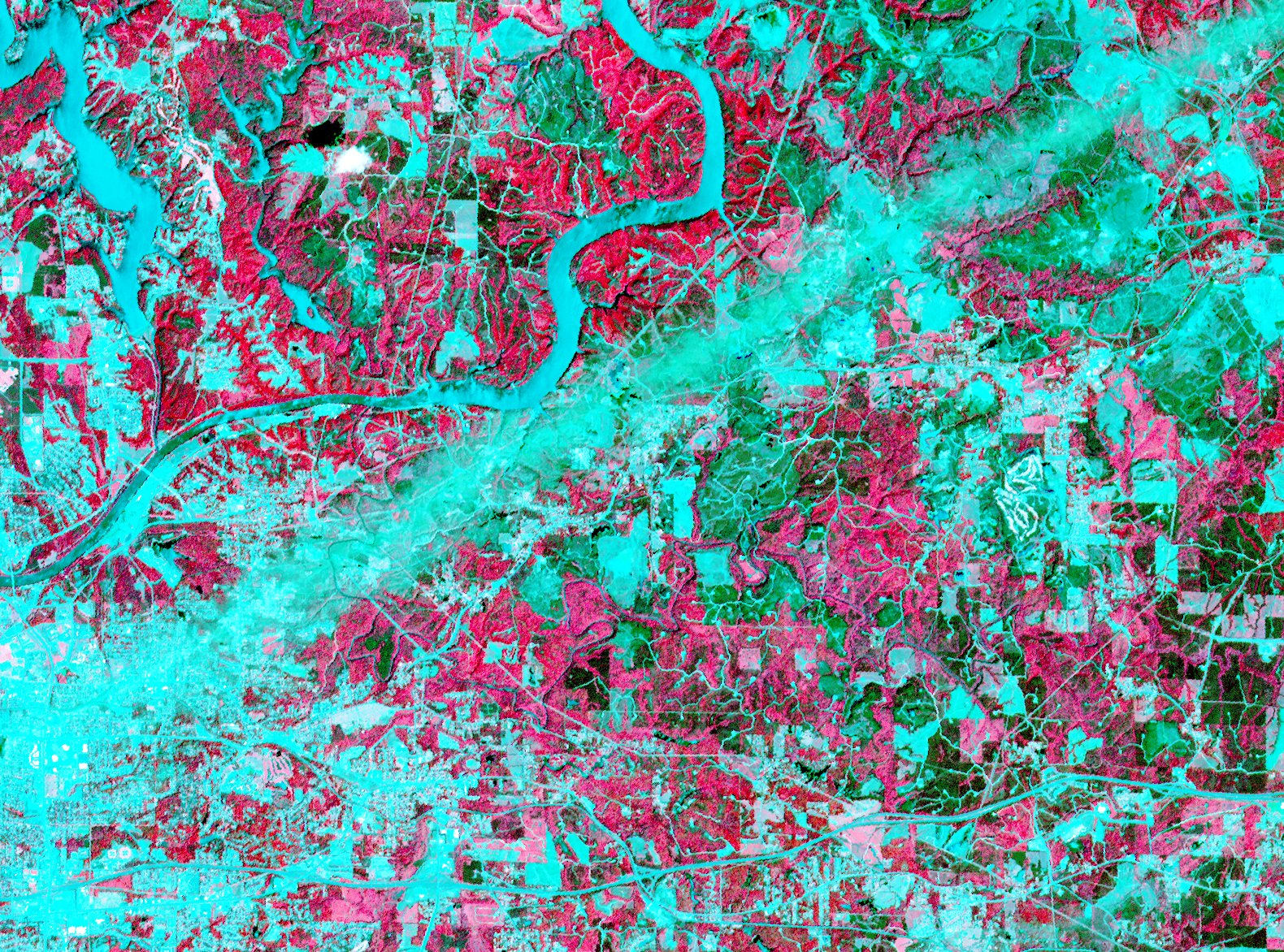
It’s amazing how clear the damage from tornadoes appears in satellite imagery. Above, an ASTER visible-infrared image of a tornado’s path near Tuscaloosa, Alabama: “In the picture, captured just days after the storm, pink represents vegetation and aqua is the absence of vegetation. The tornado ripped up everything in its path, scouring the Earth’s surface with its terrible force. The ‘tearing up’ of vegetation makes the tornado’s track stand out as a wide swath of aqua.” NASA’s Earth Observatory also has a set of satellite photos of the tornado tracks.
No comments:
Post a Comment